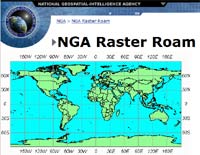
DTED files (Digital Terrain Elevation Data)
What It Is:
- a DTED file is a simple, regularly spaced grid of elevation points
- similar to USGS DEM files, but originally designed
by NIMA for military applications
- based on latitude-longitude (lat-lon)
- types of DTED:
- Level 0 - file extension .dt0
- post spacing is 30 arc second (~ one kilometer)
- usually in 1-degree square files, 121*121 data points
- similar to GTOPO30 (same resolution)
- the quality of the data appears to be better than GTOPO30
- Level 0 covers only about 50% of the area covered by GTOPO30,
but much of the difference is in Antarctica
- surprising geopolitical holes include the UK, France, Greece,
Turkey, Israel, and Korea
- Level 1, aka DTED 1
- post spacing is 3 arc seconds (~ 100 meters)
- Level 2, aka DTED 2
- post spacing is one arc second (~ 30 meters)
- Level 1 and 2 are "Not releasable outside DoD unless specifically authorized
by the HQ NIMA"
- file format is described by
MIL-PRF-89020B (pdf)
- Canada uses a highly similar format called
Canadian Digital Elevation Data (CDED)
 Where to Get It:
- all of DTED Level 0 is free online
 Where to Get It: