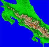
Typical of international locations, it is difficult to find free geospatial data for Costa Rica. As usual, some commercial companies (Intec/LandInfo in this case) sells some data. This means there's a financial hurdle to beginning the process (around $4500 in this case).
 In
March of 2003, a 200m elevation grid became available (see the
BT Repository). Redistribution is allowed
under the terms of the included README file. This is thanks to Patrick
Van Laake who prepared the data for the Instituto Geográfico
Nacional of Costa Rica, and the Food and Agriculture Organization of
the United Nations.
As of 2004 there is also 90m NASA SRTM, although there are plenty of gaps due to the rugged mountainous character of the country.

