Imagery: Free Sources and Directories
- ESDI
(Earth Science Data Interface) at the University of Maryland
GLCF
 (Global
Land Cover Facility)
- great map interface for finding imagery
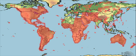
- includes LandSat7 imagery (coverage shown to the right)
- each LS band is a separate 8-bit TIF file, so you can (must)
assemble them yourself into RGB images
- MODIS Rapid Response
System
- provides true-color, 250m images of large parts of the world
- JPEG files, with world files, mostly in Sinusoidal projection
- though the focus of this site is on fires and other atmospheric
issues, they nonetheless serve up an amazing amount of beautiful
cloud-free coverage, such as the entire countries of Korea and Tibet
- although the files works reasonably well with the assumption they
are in normal Sinusoidal projection, they are reportedly actually in a
special "Integerized Sinusoidal" (ISIN) projection
- ISIN is not supported by most software, so they provide the free
MODIS
Reprojection Tool to project the data to other, well-known
projections
- the
Visible Earth: MODIS page also has a set of imagery, but it is not
as extensive or useful
- JPL OnEarth Global Mosaic

- a server using the WMS protocol to serve combinations of all nine
spectral bands of Landsat7 data
- includes a very nice 15m true-color pan-merge layer, which has
reasonable image quality, although it suffers from the usual problem of
LandSat bands which have not been individually color-balanced, as well
as cloud cover
- you can use their simple web-based browser, but since it is WMS, you
can also use any WMS-enabled client such as
World Wind for a more
powerful browsing experience
- DigitalGlobe
- Although DG is a commercial imagery vendor, they have program called
Point of Interest
which provides free access to a 10 sq. km. area to US and Canadian
governmental agencies (Non-Defense)
- OpenAerialMap
- An open collection of aerial photographs, collected into a single
coherent view of the world, served with a WMS. You can upload your
own imagery.
- NASA ESAD - Earth Science
Applications Directorate
- ESAD article at
Terrainmap.com shows how to get free false-color imagery from their
MrSID browser
- in fact, this is an excellent source of LandSat5 (1990) data for the
entire globe
- it is not true-color or cloud-free
- USGS DOQ and NAPP
- USDA-NRCS
Geospatial Data Gateway
- uses a Java-based map interface to allow selecting a geographic
area, display of (US Federal data) layers available, then FTP download
or CDROM/DVD delivery
- includes a great deal of CIR (Color Infrared) aerial photos which
are otherwise spread out on servers in individual states

-
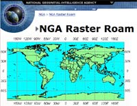
NGA Raster Roam
- when you can't find any imagery
for some part of the northern hemisphere, try this NGA server which
might have old 10 meter Digital Orthorectified Imagery (DOI 10) of your
area
- ISS EarthKAM Datasystem
- has visible-spectrum images taken from the International Space
Station
- see EarthKAM article
at Terrainmap.com for more information
- earthinfo
- a free, useful website which provides online geographic browsing,
with links to both government and commercial sites which can provide
access to imagery
- Global Land 1-KM
AVHRR Project (Advanced Very High Resolution Radiometer)
- the data is rough, low-quality - but coverage is global
- The JPL image archive's
Mission to Planet Earth
- has some high-res false-color
(SIR-C/X-SAR)
images
- includes good images of the great wall of china, central Italy,
parts of the bay area, and parts of Hawai‘i
- ResMap
- although ResMap is a commercial company, you can browse their
extensive imagery online and download (most of) the layers for free
- see their
instructions
page
- NASA Ames
- has a large collection of
visible-spectrum images taken from the shuttle, but nearly all of
them are low-contrast, clouded and oblique
- NASA Image eXchange (NIX)
-
GeoGratis
- a Canadian
website that offers LandSat coverage for all of Canada and for part of
the northern United States
- Cryptome Eyeball Series
- a large set of high-resolution aerials of locations with some
political significance; they are reportedly from the USGS, possibly via
the
National Map
Commercial sources and vendors
(large list)
 (Global
Land Cover Facility)
