Older Hawai`i Satellite Imagery
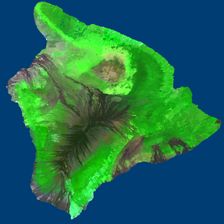
In 1997-1999, several attempts were made to get a good image of the big
island, which are now obsoleted by good LandSat7 imagery.
-
LandSat Multi Spectral Scanner (MSS) images, around 80 meters per pixel,
significant clouds
- mosaiced into a
single image
- the MSS image of Maui has this caption: "this image is part of a SPOT
multispectral image of the Hawaiian Islands. It is shown here at a spatial
resolution of 50 m/pixel. If you would like to obtain your own full
resolution (20 m/pixel) image, please contact SPOT.."
- not very usable due to cloud coverage, lack of georegistration, weird
color balance, low resolution, etc.
from TRIFID
- claimed that you can get 25m LANDSAT imagery, 4 images at $450 ea.,
merged and color-corrected, for $4360 - fusion with one (10m) SPOT image,
$5260
- it turns out that only "recent" LANDSAT is available, at $4500 each
from TerraSystems, Inc. (later STI Services, later gone)
- best color quality available was MSS (red, green, infrared), shifted to
try to resemble visible spectrum, merged with panchromatic for detail
- whole island, cloud-free, 10m detail with 20m color resolution, $25,000
- The SPOT data that TerraSystems got
has about this much resolution on each band:
Red: 4-5 bits -> mapped to Red
Green: 3-5 bits -> mapped to Blue
Near-IR: 8 bits -> mapped to Green
- delivered data:
- total size: 13420 * 15273, precisely 10m pixels
- georegistered to the UTM grid
- UTM of upper-left-corner:
- according to first drop: 176722.1, 2244372.0
- later figure: 214762.1, 2244372.0
- delivery format is TIF, with a TFW
(tiff world file) describing the location and scale of each TIF
- second delivery: had data re-sent registered to degree grid
- NW: 20° 15' 43", -156° 5' 37"
- NE: 20° 16' 48", -154° 48' 37"
- SW: 18° 53' 03", -156° 04' 03"
- SE: 18° 54' 02", -154° 47' 42"
- significant hand-editing still required to:
- adjust color curves over large areas with completely wrong color
balance
- tedious tweaking in specific areas, occasionally requiring
near-total desaturation - e.g.. purple desert and lava fields
- clean up color-shifted regions: near bodies of water and coastlines
- fourth delivery, in UTM zone 5 coordinates
- four sections
| Filename |
size |
UTM coords of top-left corner |
| big_island1.tif |
6937 x 7835 pixels |
174484 |
2246386 |
| big_island2.tif |
6939 x 7835 pixels |
243844 |
2246386 |
| big_island3.tif |
6937 x 7837 pixels |
174484 |
2168046 |
| big_island4.tif |
6939 x 7837 pixels |
243844 |
2168046 |
- has a black border: left 228, right 229, top 201, bottom 199 pixels
- after removing border:
| Filename |
size |
UTM coords of top-left corner |
| big_island1.tif |
6709 x 7634 pixels |
176764 |
2244376 |
| big_island2.tif |
6710 x 7634 pixels |
243844 |
2244376 |
| big_island3.tif |
6709 x 7638 pixels |
176764 |
2168046 |
| big_island4.tif |
6710 x 7638 pixels |
243844 |
2168046 |
- Combined size: 13419 x 15272 @ 10 m/pixel
- Resized to 8192 x 8192: 16.3 by 18.6 m/pixel
- Resized to 4096 x 4096: 32.6 by 37.2 m/pixel


 (later STI Services, later gone)